
Scenic Loop – Helotes Creek Alliance
Neighborhood Conservation District (NCD)
Executive Summary
In response to the City’s 1997 Master Plan and the 1998 Community Revitalization Action Group (CRAG) Report, the Neighborhood Conservation District (NCD) was created to be a proactive tool to address neighborhood sustainability through compatible infill construction and rehabilitation in unique areas of the city.
Since the adoption of the NCD enabling ordinance and development of the NCD program, nine (9) NCD ordinances have been approved by City Council; South Presa Street/South St. Mary’s Street (NCD-1), Alta Vista (NCD-2), Ingram Hills (NCD-3), Whispering Oaks (NCD-4), Beacon Hill Area (NCD-5), Mahncke Park (NCD-6), Jefferson (NCD-7), Woodlawn Lake Area (NCD-8) and Westfort Alliance (NCD-9)
The Scenic Loop – Helotes Creek Alliance neighborhood was selected for designation based upon goals and objectives defined by it residents. (1) maintain the status of the historic Scenic Loop Road from Hwy 16 (Bandera Rd) to the Babcock Rd as a rural road; (2) keep the native tree canopy intact, and protected from the spread of Oak Wilt; (3) protect the visual, physical and aesthetic qualities of the existing Corridor; (4) support protection of the region’s historical and cultural integrity; and (5) support protection and preservation of the region’s natural beauty and resources to include water, endemic, endangered species, viewshed and dark sky.
There are approximately 6,000 acres and 1,000 parcels within the district. Neighborhood Conservation Districts can be established in areas that possess distinctive character-defining features, where at least 75% of the land area within the district contains structures that are at least 25 years old and at least 75% of the land area within the district is improved or developed. The proposed Scenic Loop – Helotes Creek Alliance NCD meets the ordinance requirements with ##% of the land area containing structures that are 25 years or older and ##% of the land area presently improved.
The residential architecture is dominated by rural estate and ranch type homes built predominantly using locally sourced stone and timbers. Even though the corridors history includes structured dating back to the mid 1800’s, the Grey Forest region of the neighborhood was master planned in the 1920’s, and the Helotes region of the neighborhood was master planned in the 1970’s. Larger parcel’s throughout our neighborhood are typically subdivisions of family ranches as they are handed down through the generations. These larger residential estate parcels range in size from 2 acres to about 60 acres each. Due to the neighborhood residents objectives of preserving their corridors natural beauty and its historical park-like qualities, efforts to install water and sewer infrastructure have been deterred. As such, there is little interest to further subdivide and/or develop within the neighborhood.
The Scenic Loop – Helotes Creek Alliance Neighborhood includes residential estate, single-family residential and a small number of commercially zoned parcels that cross 3 different municipalities (San Antonio, Helotes and Grey Forest; and each of their ETJ’s). Each of these municipalities has their own documented residential design standards that must be followed as applicable to the parcel being developed.
While the architecture of the area is an important feature, the design standards found in this plan are not intended to enforce architectural style, but rather to (1) perpetuate the historic Scenic Loop Road as a rural park-like road; (2) keep the native tree canopy intact; (3) protect the visual, physical and aesthetic qualities of the corridor; (4) support protection of the region’s historical and cultural integrity; and (5) protect and preserve the region’s natural beauty, resources, viewshed and dark sky.
The design standards expressed in this document are not intended to make building improvements or development financially burdensome. The completion of the designation process brings to fruition the neighborhood’s ideals of protecting and preserving the unique character of the Scenic Loop – Helotes Creek Alliance Neighborhood area; an idea and process which has been carefully nurtured over several decades. In addition, this designation meets the intent and upholds the spirit of the Neighborhood Conservation District Program.
How To Use This Document:
The Scenic Loop – Helotes Creek Alliance Neighborhood Conservation District Plan is divided into five major sections: the Residential Design Standards, Residential Design Guidelines, Non-Residential Design Standards, Park Lands, and Appendices.
The Residential Design Standards specifically address design related requirements for properties that are zoned for any form of residential uses. In many areas within the Design Standards section, the intent of specific standards is discussed. This helps represent and explain the community’s values of appropriate design solutions which is intended to further the cause of preserving the neighborhood character.
There are no design standards that apply to non-residential uses with structures originally designed for commercial use within the district. As of the date of the adoption of the ordinance, non-residential structures that were originally designed as commercial structures may not have to comply with the NCD Design Standards, though could be if the district standards were to be amended to include commercial or non-residential structures in the future. However, structures within the district that were originally built for residential use, but converted to commercial
use shall be required to comply with NCD standards. Original residential use shall be determined through the Sanborn Fire Insurance Maps and City Directories
Each section attempts to explain the intent behind the design standard. The intent has been gathered from public meetings, planning team discussions, and survey findings. In some cases, illustrations and pictures are used to clarify concepts and ideas. The glossary also provides specific definitions intended to clarify potentially ambiguous terminology and concepts.
The final sections of this document include the map appendix (Appendix X) which helps to graphically identify the character and defining features found in the neighborhood; the Property Owners Listing (Appendix X), which is a required component of the NCD plan as set forth by UDC Section 35-335, Neighborhood Conservation Districts.
Residential Design Standards
§ 35-335.e3
(3) The design standards for the neighborhood conservation district must include at a minimum (or note the in-applicability), the following elements governing the physical characteristics and features of all property (public or private) within the proposed district:
A. Building height, number of stories; – No building shall exceed thirty-five (35) feet in height and be greater than two and one-half floors.
B. Building size, massing; – All parcels shall be zoned for residential single-family or residential estate use. Exception is given to lots or parcels zoned prior to the effective date of this ordinance.
C. Principal elevation features; – Not applicable. The objectives of this NCD will not focus on architectural standards, however the applicable municipality governing your lot or parcel may have architectural guidelines and/or standards that shall be followed.
D. Lot size, coverage; – The minimum area of the lot shall be 2 acres. The minimum width of the lot shall be 120 feet. The minimum depth of the lot shall be 120 feet. Exception is given to lots or parcels platted prior to the effective date of this ordinance.
E. Front and side setbacks; The front setback along Scenic Loop Road shall be a minimum of 100 feet, other parcels not abutting Scenic Loop Road shall have a minimum front setback of 40 feet. Side yard and rear yard setbacks shall not be less than 25 feet. Exception is given to lots are parcels platted prior to the effective date of this ordinance.
F. Off-street parking and loading requirements; – UDC Division 6, 35-525-526 stipulates a minimum of 1 off-street parking space required for single-family dwellings, with no restrictions of the location on the parcel. For single family dwellings, parking for a minimum of 2 vehicles per dwelling unit shall be accommodated or stored in a parking structure. No parking will be permitted on streets or public right of ways.
G. Roof line and pitch; – Not applicable. The objectives of this NCD will not focus on architectural standards, however the applicable municipality governing your lot or parcel may have architectural guidelines and/or standards that shall be followed.
H. Paving, hardscape covering. – Impervious Cover for all residential lots must not exceed 30% of the total lot area. Impervious cover includes non-permeable surfaces such as roads, parking areas, driveways, buildings, pools, patios, sheds, sidewalks, and other impermeable construction covering the natural land surface.
§ 35-335.e4
(4) In addition, the design standards may include, but shall not be limited to, the following elements:
A. Building orientation; – Not applicable. The objectives of this NCD will not focus on architectural standards, however the applicable municipality governing your lot or parcel may have architectural guidelines and/or standards that shall be followed.
B. General site planning (primary, ancillary structures); – Not applicable. The objectives of this NCD will not focus on architectural standards, however the applicable municipality governing your lot or parcel may have architectural guidelines and/or standards that shall be followed.
C. Density; – Increased residential density is discouraged.
D. Floor area ratio; – The Floor Area Ratio (FAR) uses a Floor Space Index (FSI) to determine the ratio of total living space allowed on a lot or parcel relative to the size of the lot or parcel. This ratio protects the character of the neighborhood by ensuring appropriately scaled structures. The Scenic Loop – Helotes Creek Alliance Neighborhood has adopted a 0.10 FSI multiplier to be used to calculate the maximum living space (square footage) of the principal dwelling structure. (Lot Size) X (FSI) = maximum floor space permitted. Living Space- the total square footage of livable space. Living space excludes covered porches, patios, stoops, and other areas distinctly separate from the primary living area. Total living space includes all levels and stories of the principal dwelling structure. The combined square footage for all detached accessory structures (garages, carports, detached dwelling) shall not exceed 40% of the square footage of the living space of the primary dwelling.
E. Signage; – Moving signs, LED signs, blinking or flashing signs are not permitted. Portable and/or inflatable signs are not permitted. Off premise (billboard) signs are not permitted. The objectives of this NCD will not focus on architectural standards, however the applicable municipality governing your lot or parcel may have architectural guidelines and/or standards that shall also be followed.
F. Architectural style and details; – Not applicable. The objectives of this NCD will not focus on architectural standards, however the applicable municipality governing your lot or parcel may have architectural guidelines and/or standards that shall be followed.
G. Building materials; – Not applicable. The objectives of this NCD will not focus on architectural standards, however the applicable municipality governing your lot or parcel may have architectural guidelines and/or standards that shall be followed.
H. Garage entrance location; – Not applicable. The objectives of this NCD will not focus on architectural standards, however the applicable municipality governing your lot or parcel may have architectural guidelines and/or standards that shall be followed.
I. Window/dormer size and location; – Not applicable. The objectives of this NCD will not focus on architectural standards, however the applicable municipality governing your lot or parcel may have architectural guidelines and/or standards that shall be followed.
J. Landscaping; – The provisions of the UDC §35-523 (version in use at the time of adoption of this zoning overlay district, included for reference) shall be upheld as minimum landscaping standards for all new projects. City staff shall review tree preservation and help to propose alternative site and building arrangements prior to any degree of mitigation. In addition to the standards noted in UDC Section 35-523, a tree survey (noting tree species and size) is required for all new construction or rehabilitation (if enlarging building footprint), noting location, canopy and caliper of all trees 6: DBH and over. If the proposed area of a new construction necessitates the removal of any Significant, Heritage and Historic trees that are more than 20” DBH, an alternative site plan review will be required. This site plan review, conducted by the City Arborist, will determine and offer suggestions for alternative building areas, and/or satisfaction of mitigation requirements. Significant Heritage and Historic Trees shall not be removed unless no other site plan alternative is feasible.
K. Fences and walls; – Not applicable. The objectives of this NCD will not focus on architectural standards, however the applicable municipality governing your lot or parcel may have architectural guidelines and/or standards that shall be followed.
L. Entrance lighting; – For new area lighting fixtures mounted overhead on poles, mounting height shall not exceed fifteen feet (15’-0”), and the axis of illumination shall be adjusted to an angle not more than twenty (20) degrees from the vertical line between the fixture and the ground. For new area lighting using fixtures having an output of more than 1800 lumens, mounted at or near ground level and used to light a structure or other object, the axis of illumination shall be adjusted to minimize the amount of light escaping above, below and to the sides of the illuminated object. Light Trespass – All new lighting shall be aimed, located, designed, shielded, fitted and maintained so as not to project light onto a neighboring use or property.
M. Driveways, curbs and sidewalks; – Parking spaces shall be completely separated and screened and buffered from the streetscape. When feasible, parking shall be located behind the building. Screening materials may include landscape or other vegetation (shrubs, trees) or wall or fence structure with a maximum of three feet (3’) in height.
N. Utility boxes, trash receptacles; – Not applicable. The objectives of this NCD will not focus on architectural standards, however the applicable municipality governing your lot or parcel may have architectural guidelines and/or standards that shall be followed.
O. Street furniture; – Not applicable. The objectives of this NCD will not focus on architectural standards, however the applicable municipality governing your lot or parcel may have architectural guidelines and/or standards that shall be followed.
P. Solar systems, components; – Not applicable. The objectives of this NCD will not focus on architectural standards, however the applicable municipality governing your lot or parcel may have architectural guidelines and/or standards that shall be followed.
Q. Building relocation; – Not applicable. The objectives of this NCD will not focus on architectural standards, however the applicable municipality governing your lot or parcel may have architectural guidelines and/or standards that shall be followed.
R. Right-of-way (exceeding public works standards). – Not applicable. The objectives of this NCD will not focus on architectural standards, however the applicable municipality governing your lot or parcel may have architectural guidelines and/or standards that shall be followed.
Residential Design Guidelines
Building height, number of stories
Height of primary dwelling is measured from grade to highest point or pitch of the roof. Height of accessory structures (garages, carports, sheds, and other structures) shall not exceed 12 feet or 80% of the height of the primary dwelling, whichever is greater. No accessory structure may be taller than the primary dwelling.
Building size, massing
Square footage will be calculated by using the most current data provided by the Bexar County Appraisal District. Bexar County Appraisal data supersedes any and all other property and building information. It is the responsibility of the applicant to address any discrepancy with the County Appraisal office.
Lot size, coverage
The FAR calculation is intended to manage the massing and lot coverage of a particular parcel. When parcels are assembled and/ or subdivided, this allows an opportunity to influence the FAR calculation. To ensure an appropriately scaled neighborhood streetscape and building configuration, the process for re-platting, subdividing, and assembling parcels must be reasonably maintained. Due to the requirement for well and septic throughout most of the neighborhood lot sizes quite often have required minimum sizes to qualify for on-site sewage facilities and water well placement to meet separation distance and placement within setbacks on each lot or parcel. The rugged terrain within the neighborhood tends to dictate structure placement on each parcel or lot.
Front and side setbacks
The setback along Scenic Loop Road is designed to retain the tree canopy and natural buffer between the road surface and any new structures. The rear and side setbacks are designed to preserve natural buffers between structures.
Off-street parking and loading requirements
No parking will be permitted on streets or public right of ways. In order to preserve the visual, physical and aesthetic qualities of our corridor we intend to prevent contraction of parked vehicles in all thorough fares.
Paving, hardscape covering
The easiest way to retain the natural park like qualities of the corridor is minimize impervious cover.
Non-Residential Design Standards
Several commercially zoned parcels or lots exist with the defined neighborhood. These are located between Whip O Whil and SH16 along Scenic Loop Road, near the intersection of Scenic Loop Road and Babcock Road and finally those as permitted in Grey Forest. Exception is given to lots or parcels zoned prior to the effective date of this ordinance.
Parklands
Rancho Diana – (CoSA Parks and Recreation) (Friends of Friedrich Wilderness Park) (1074.3 Acres)
Scenic Canyons – (CoSA Parks and Recreation) (Friends of Friedrich Wilderness Park) (452.7 Acres)
Senator Frank L. Madla Natural Area – (CoGF) (42 Acres)
Scenic Loop Playground Club – (Grey Forest Community Board) (20 Acres)
Appendices
Appendix A
ENABLING ORDINANCE
San Antonio – Unified Development Code – Article III. Zoning – Division 4. Overlay Districts:
§ 35-335. “NCD” Neighborhood Conservation District
(a) Purpose.
(1) Within the City of San Antonio there are many unique and distinctive residential neighborhoods or commercial districts which contribute significantly to the overall character and identity of the city. They are worthy of preservation and protection, but may lack sufficient historical, architectural or cultural significance at the present time to be designated as historic districts. As a matter of public policy, the city council aims to preserve, protect, enhance, and perpetuate the value of these residential neighborhoods or commercial districts through the establishment of neighborhood conservation districts.
(2)
(b) Designation Criteria.
(1) Contain a minimum of one (1) blockface (all the lots on one (1) side of a block);
(2) At least seventy-five (75) percent of the land area in the proposed district was improved at least twenty-five (25) years ago, and is presently improved; and
(3) Possess one (1) or more of the following distinctive features that create a cohesive identifiable setting, character or association:
A. Scale, size, type of construction, or distinctive building materials;
B. Spatial relationships between buildings;
C. Lot layouts, setbacks, street layouts, alleys or sidewalks;
D. Special natural or streetscape characteristics, such as creek beds, parks, greenbelts, gardens or street landscaping;
E. Land use patterns, including mixed or unique uses or activities; or
F. Abuts or links designated historic landmarks and/or districts.
(c) Zoning Authority. Separate ordinances are required to designate each “NCD” neighborhood conservation district. Ordinances designating each district shall identify the designated boundaries, applicable designation criteria and design standards for that district, and be consistent with any existing neighborhood and/or community plans.
J. Scenic Loop – Helotes Creek Alliance “NCD-10,” Month DD, YYYY.
(1) Overlay District. Neighborhood conservation districts are designed as overlays to the regular zoning districts. Property designated within these districts must also be designated as being within one (1) or more of the regular base zoning classifications.
Authorized uses must be permitted in both the regular zoning district and the overlay district. Property designated as a neighborhood conservation district may have additional designations. Such property shall comply with all applicable use restrictions.
(2) Zoning Designation. The zoning designation for property located within a neighborhood conservation district shall consist of the base zone symbol and the overlay district symbol “NCD” as a suffix. Neighborhood conservation districts shall be numbered sequentially to distinguish among different districts, i.e., “R-6-NCD-1,” “C-1-NCD-2,” etc.
A. The designation of property within a neighborhood conservation district places such property in a new zoning district classification and all procedures and requirements for zoning/rezoning must be followed.
B. In the event of a conflict between the provisions of a specific neighborhood conservation district ordinance and the regular base zoning district regulations, the provisions of the neighborhood conservation district ordinance shall control.
C. Except as modified by this section, the procedures for zoning changes set forth in this chapter shall otherwise apply to the designation of an area as a neighborhood conservation district.
D. Upon designation of an area as a neighborhood conservation district, the city council shall cause notice of such designation to be recorded in the official public records of real property of Bexar County, the tax records of the City of San Antonio and the Bexar Appraisal District, and the house numbering section of the City of San Antonio’s department of planning and development services.
(d) Initiation Procedure
(1) A zoning change application for designation as a neighborhood conservation district shall be initiated at the direction of the:
A. A request of owners representing fifty-one (51) percent of the land area within the proposed district, or
B. Request of fifty-one (51) percent of property owners within the proposed district, or
C. Planning and community development director, pursuant to a neighborhood or community plan adopted by city council, or city or community revitalization program.
(2) Following initiation for designation of a neighborhood conservation district, the department of planning and community development shall develop a neighborhood conservation plan for the proposed district that follows subsection 35-335(b)(3) and includes:
A. Maps indicating boundaries, age of structures and existing land use within the proposed district.
B. Maps and other graphic and written materials identifying and describing the destrict neighborhood and building characteristics of the proposed district.
C. A list of all property owners (with legal addresses), neighborhood associations and/or other organizations representing the interests of property owners in the proposed district.
D. Design Standards
(3) All property owners within the proposed district shall be afforded the opportunity to participate in drafting the neighborhood conservation plan, which will be approved as part of the zoning ordinance creating a neighborhood conservation district.
(e) Design Standards.
(1) The neighborhood conservation plan approved as part of the zoning ordinance creating a neighborhood conservation district shall include design standards for new construction of any building or structure, or the relocation or rehabilitation to the street facade of an existing building or structure.
(2) The neighborhood conservation plan, and requisite design standards shall not apply to those activities which constitute ordinary repair and maintenance, i.e., using the same or similar material and design.
(3) The design standards for the neighborhood conservation district must include at a minimum (or note the inapplicability), the following elements governing the physical characteristics and features of all property (public or private) within the proposed district:
A. Building height, number of stories;
B. Building size, massing;
C. Principal elevation features;
D. Lot size, coverage;
E. Front and side setbacks;
F. Off-street parking and loading requirements;
G. Roof line and pitch;
H. Paving, hardscape covering.
(4) In addition, the design standards may include, but shall not be limited to, the following elements:
A. Building orientation;
B. General site planning (primary, ancillary structures);
C. Density;
D. Floor area ratio;
E. Signage;
F. Architectural style and details;
G. Building materials;
H. Garage entrance location;
I. Window/dormer size and location;
J. Landscaping;
K. Fences and walls;
L. Entrance lighting;
M. Driveways, curbs and sidewalks;
N. Utility boxes, trash receptacles;
O. Street furniture;
P. Solar systems, components;
Q. Building relocation;
R. Right-of-way (exceeding public works standards).
(f) Neighborhood Ordinance Administration.
(1) No building permit shall be issued by the department of planning and development services for new construction or an alteration or addition to the street facade of an existing building or structure within a designated neighborhood conservation district without the submission and approval of design plans and the issuance of a certificate of compliance by planning and community development director.
(2) The director of planning and community development shall forward a copy of a building permit application to the director of planning and development services for review and comment.
(g) Violation of Provisions.
(1) The violation of any provision of this section shall constitute a violation of this chapter and may be prosecuted in municipal court regardless of whether civil or administrative action is taken against the permit holder. Upon conviction, the permit holder shall be subject to the penalties prescribed in this chapter.
(2) The director of planning and development services may request the city attorney to institute a civil action as prescribed in this chapter, regardless of whether a criminal action has been taken.
Appendix B
GLOSSARY
Appendixx C
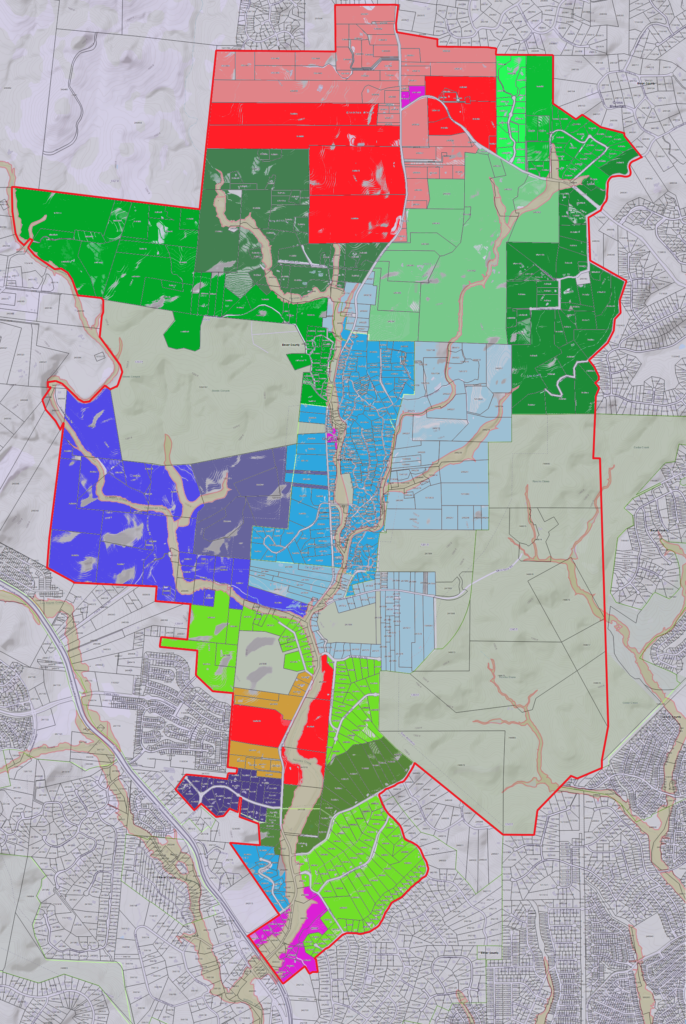
NEIGHBORHOOD MAPS
Appendix D
LISTING OF PROPERTY OWNERS
Appendix E
NCD MEETING SCHEDULE
ATTACHMENT 1 – ZONING COMMISSION DOCUMENTATION
ATTACHMENT 2 – HELOTES CITY COUNCIL APPROVED ORDINANCE
ATTACHMENT 2 – GREY FOREST CITY COUNCIL APPROVED ORDINANCE
ATTACHMENT 2 – SAN ANTONIO CITY COUNCIL APPROVED ORDINANCE