Skip to content
  • Home
  • Library
    • Biblioboard.com
    • Places of Interest
    • People of Interest
    • The Early Corridor
    • Historic Sites
    • Historic Cemeteries
    • Corridors Natural Resources
    • The Alliance
    • Media
  • Committees
    • Greenspaces / Waterways
    • History
      • Historical Resources
    • Roads and Traffic
      • Roads Group Resources
    • Zoning
      • NCD
    • Membership
  • Recent News
  • Calendar
  • About
    • Board
    • Bylaws
    • Contact Us
    • Login
  • Donate Here

sample

Scenic Loop Playground Historical Marker 
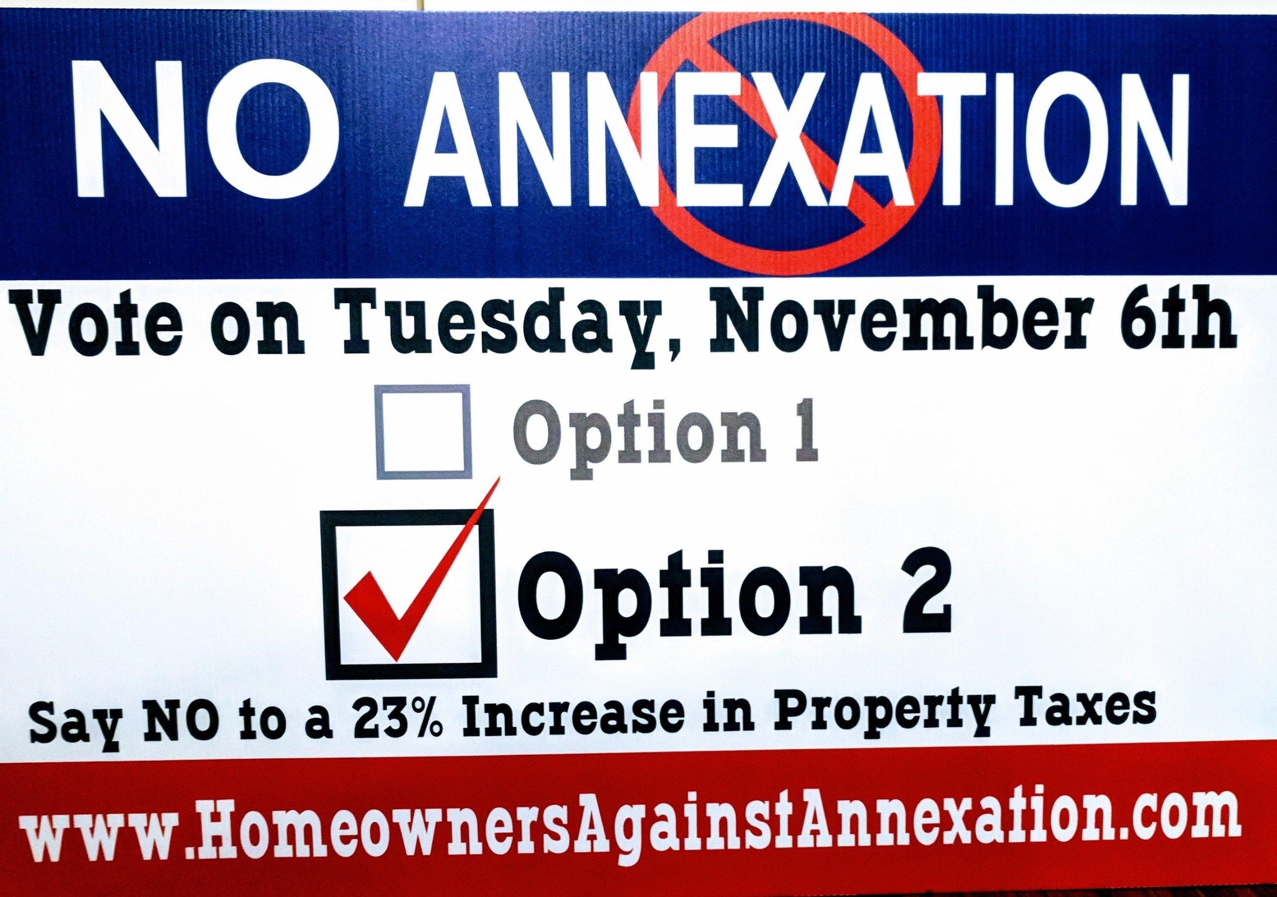
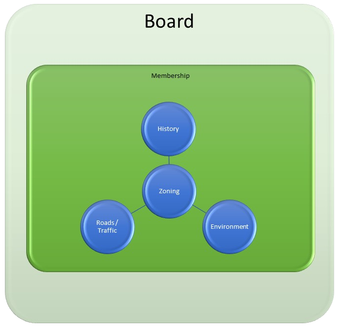
by-laws signed Aug 16, 2018 Scenic Loop Playground Swimming Pool 
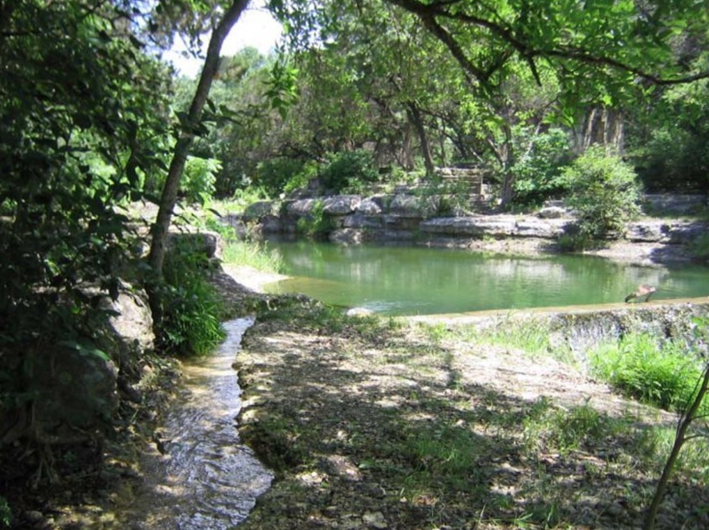
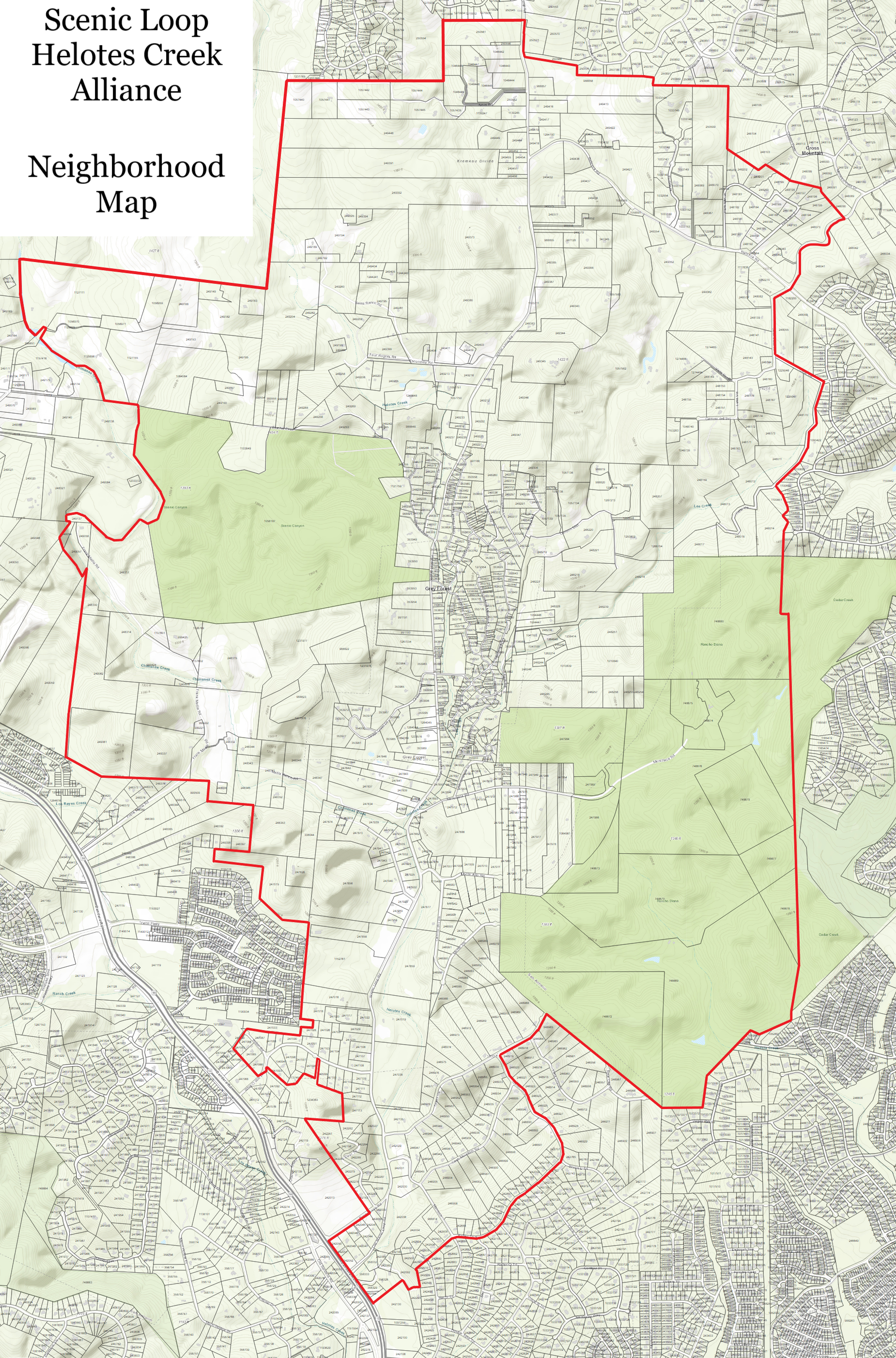
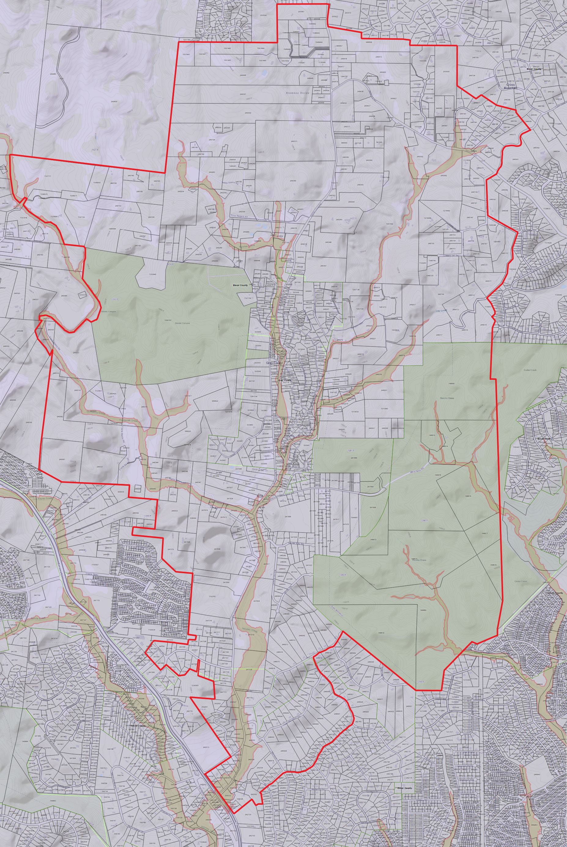
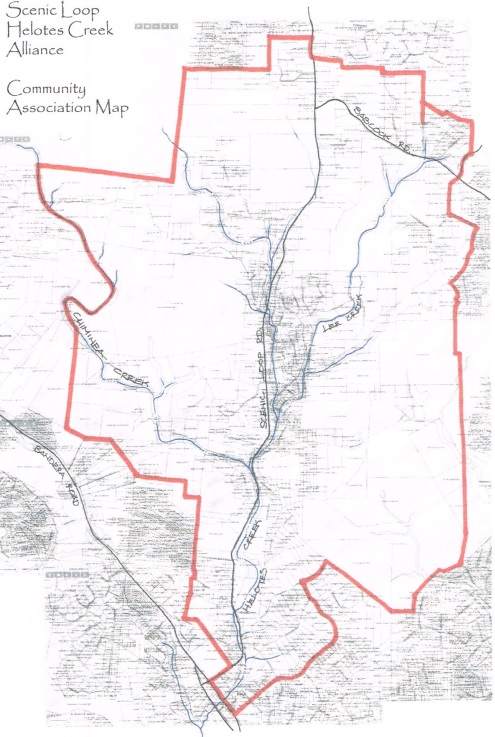
Original map provided to the Alliance by a member ensuring inclusion of all of the creeks flowing into and through our corridor. This map was originally provided to the City of San Antonio when establishing recognition of our neighborhood.

Scenic Loop - Helotes Creek Alliance Neighborhood map with Waterways
Scenic Loop – Helotes Creek Alliance Neighborhood map with Waterways

Emory and Mason Camp Bullis Road Amendments Map

  • Instagram
  • Twitter
  • Facebook
2025 Scenic Loop - Helotes Creek Alliance
Powered by WordPress and HybridMag.
  • Home
  • Library
    • Biblioboard.com
    • Places of Interest
    • People of Interest
    • The Early Corridor
    • Historic Sites
    • Historic Cemeteries
    • Corridors Natural Resources
    • The Alliance
    • Media
  • Committees
    • Greenspaces / Waterways
    • History
      • Historical Resources
    • Roads and Traffic
      • Roads Group Resources
    • Zoning
      • NCD
    • Membership
  • Recent News
  • Calendar
  • About
    • Board
    • Bylaws
    • Contact Us
    • Login
  • Donate Here